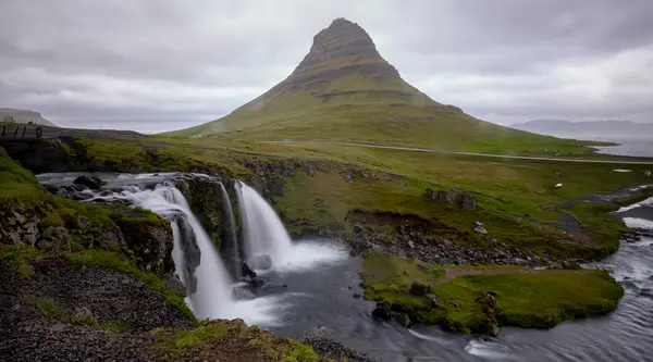
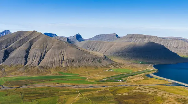
Inside Álftafjörður
Red overlay marks every azimuth where the terrain rises above the sun's altitude. Here it covers most of the sky on the sun's bearing.
On August 12, 2026, totality lasts just over two minutes — and clouds and terrain decide who actually sees it. EclipseChase ranks every viewing spot by clear-sky odds, horizon, and totality time, so you can plan ahead and move to the best one on the day.
The next total solar eclipse over Iceland isn't until 2196.
Iceland · 12 Aug 2026 · find the clearest sky
The dashboard
Live data, terrain checks, and road cams in one place. Designed for offline use when cell signal drops.
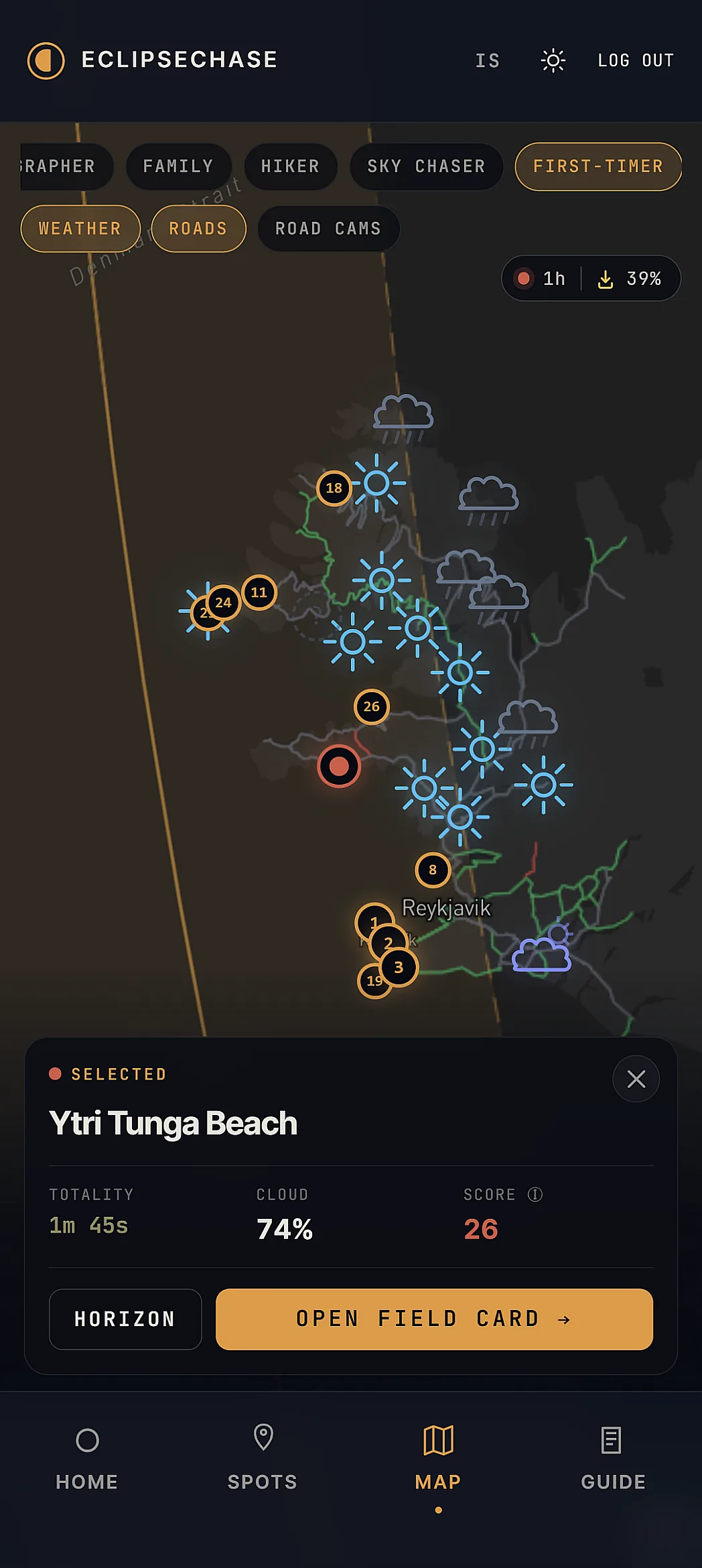
Compare totality time, cloud cover, and conditions across the whole path at a glance.
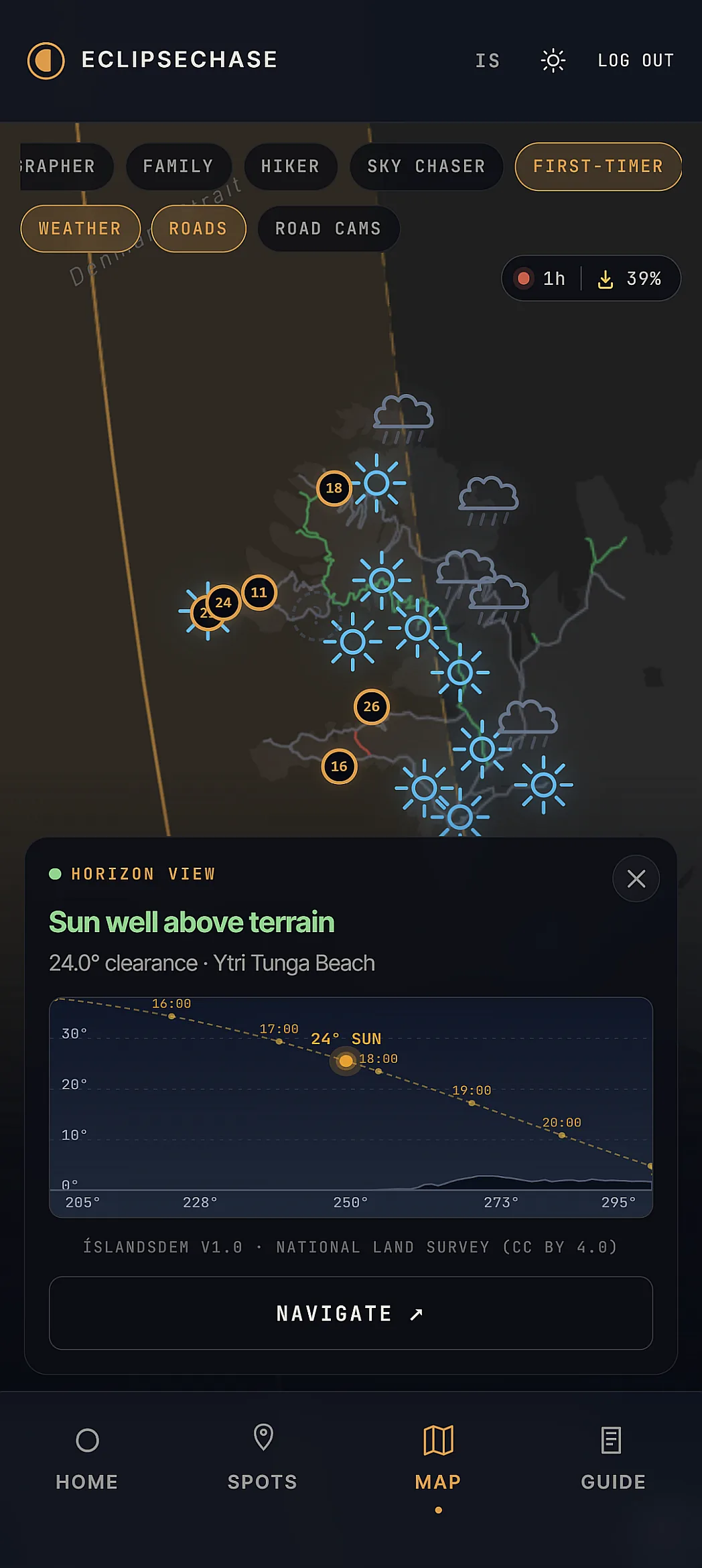
Tap any spot to see its horizon profile — terrain checked against ÍslandsDEM 30m elevation data.
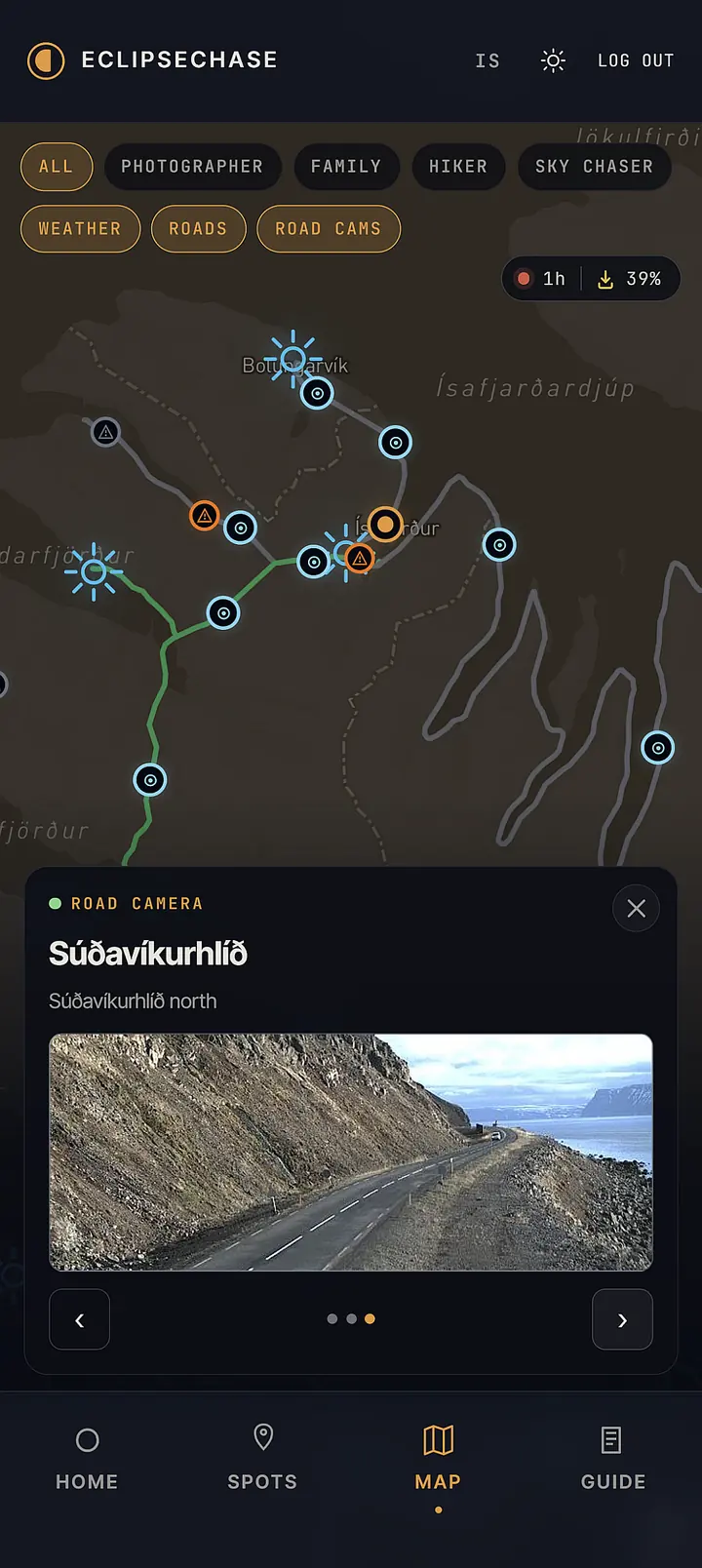
Live cameras from Vegagerðin show real conditions on the way to your spot.
The tradeoff
Totality runs from Snæfellsnes through Reykjanes — but the cloud history flips as you head southwest. August 12 has been clear roughly 24% of the last 10 years at Öndverðarnes, 41% at Garðskagi. You trade about 30 seconds of totality for the better odds.
 2M 10S · 76% CLOUDY
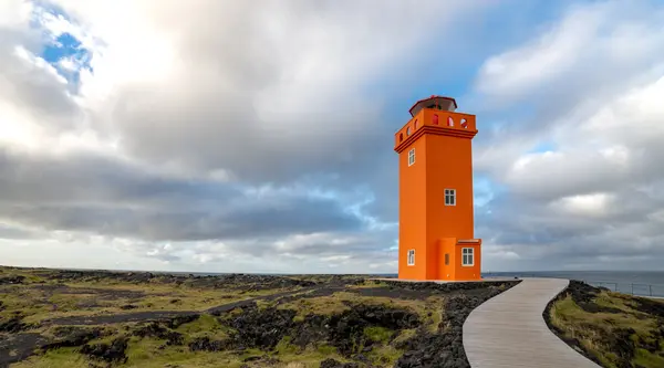
Westernmost tip of Snæfellsnes. Black basalt cliffs and the orange Skálasnagaviti lighthouse. Long totality, but cloud cover is more variable than Reykjanes.
See cloud history →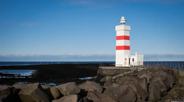 1M 40S · 59% CLOUDY
Northwesternmost tip of the Reykjanes peninsula, 15 minutes from Keflavík Airport. Less totality, but 4 of the last 10 August 12s have been clear or near-clear — the best odds on the path.
See cloud history →Cloud history from ERA5 reanalysis, August 12 at 17:45 UTC, 2016–2025. Past years don't guarantee 2026 conditions.
WHO'S WATCHING WITH YOU
Tap a profile. The same spots re-rank around what actually matters to you — and some drop out entirely.
Safe, easy, good odds. No wrong answer for your first eclipse.
Spots re-ranked for First-Timer
How we measure
Every viewing location runs through the same routine: a 91-ray sweep across the sun's bearing, sampled against ÍslandsDEM 30 m elevation data and corrected for Earth curvature plus atmospheric refraction. The dashed arc plots the sun's path across August 12 — the marker is totality.
Sun shown at totality — 17:46 UTC on August 12, 2026.
ONCE IN 170 YEARS
On August 12, 2026 the Moon's shadow crosses western Iceland for just over two minutes — then it's gone for 170 years. Clouds and terrain decide who actually sees it. Increase your chances: check the horizon and cloud history before you commit to a spot.
FREE VS PRO
Browse every spot, totality time, horizon profile, and 10 years of cloud history for free — enough to build your shortlist before you fly. Pro turns that shortlist into a live decision on August 12: real-time cloud cover, instant horizon checks, and road cams so you can move to clearer skies.
| FREEPlan | PRO €9.99Decide | |
|---|---|---|
| Plan your day in advance | ||
| Browse every viewing spot with photos & full details | ✓ | ✓ |
| Exact totality times, sun position & horizon profile per spot | ✓ | ✓ |
| 10-year historical cloud cover for August 12 | ✓ | ✓ |
| Long-form eclipse guide | ✓ | ✓ |
| Decide on the day | ||
| Live cloud-cover map, refreshed every 15 min | — | ✓ |
| Personalised "best spot for you right now" | — | ✓ |
| Tap anywhere on the map for an instant horizon check | — | ✓ |
| Live road conditions + roadside camera feeds | — | ✓ |
| One-glance dashboard: countdown + best region + your top 3 | — | ✓ |
| On the road | ||
| Offline map (keeps working without signal) | — | ✓ |
Don't leave your one shot to chance — Pro's live scoring, horizon checks, and road cams help you move to clearer skies on the day.
Eclipse Pro — €9.99
One-time payment. No subscription. No account needed. Works offline through August 31, 2026.
Get Eclipse Pro →Already have Pro from another device?Restore purchase
QUESTIONS
No. Free features work without signup. Pro is unlocked by purchase — no email/password required. Restore on any device with your purchase email.
Yes. Pro users can download offline maps and full spot data. Essential for the Westfjords where cell service is unreliable.
For curated viewing spots, very high — terrain at 30 m resolution (ÍslandsDEM v1.0), Skyfield-computed sun position, sampled at the spot's exact coordinates. For tap-anywhere checks on the map, your tap snaps to the nearest pre-computed grid point — typically within ~150 m on roads, up to ~2 km in the back-country. The map shows the snapped sample point whenever it's more than ~250 m from where you tapped. The verdict (clear/marginal/risky/blocked) reflects terrain only — weather is reported separately.
Cloud cover in Iceland is unpredictable. We provide forecasts and live conditions; you choose. The Pro recommendation engine on the day suggests where to move based on current conditions.
One email when forecasts firm up. One on eclipse day with conditions. No spam.
Built on real data: ÍslandsDEM 30m terrain · Veðurstofa Íslands weather · Skyfield eclipse computation
DATA SOURCES